Mt Davis
| Pennsylvania |
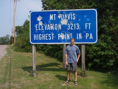
Elevation: 3,213'
Vertical Gain: 0'
Vertical Gain: 0'
Date: July 8, 2010
Time: 4:10 PM
Time: 4:10 PM
Weather: Warm, hazy
Party: Bob, Kevin
Party: Bob, Kevin
Mt Davis was the first highpoint of a three state tour, having left home the same day in my new
Nissan Rogue for it's first long trip. With Kevin working a ropes course at a camp and having
to return to school a few weeks early for soccer, there was not much time for highpointing this
summer. Only slightly out of the way on this drive was the United 93 crash site to which we
paid a somber visit. The viewing area was above but hundreds of yards away from the actual
crash site which we could make out but was not well marked. Construction had started on a
memorial due to be completed by the 10-year crash anniversary next year. A ranger on site
explained how the memorial would be aligned with the west to east flight path of the plane
which flew over the current viewing area. Over a hill to the northwest we could hear the
mechanical sounds of coal mining in process.
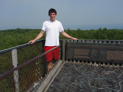
Mt Davis was a drive-up for us as I could not find any trails from the bottom. The views from
the tower were a bit hazy but it was otherwise a nice summer day in the mid-90's. From here
we headed the car south towards the Maryland highpoint.
Nissan Rogue for it's first long trip. With Kevin working a ropes course at a camp and having
to return to school a few weeks early for soccer, there was not much time for highpointing this
summer. Only slightly out of the way on this drive was the United 93 crash site to which we
paid a somber visit. The viewing area was above but hundreds of yards away from the actual
crash site which we could make out but was not well marked. Construction had started on a
memorial due to be completed by the 10-year crash anniversary next year. A ranger on site
explained how the memorial would be aligned with the west to east flight path of the plane
which flew over the current viewing area. Over a hill to the northwest we could hear the
mechanical sounds of coal mining in process.
Mt Davis was a drive-up for us as I could not find any trails from the bottom. The views from
the tower were a bit hazy but it was otherwise a nice summer day in the mid-90's. From here
we headed the car south towards the Maryland highpoint.
Frustrated hunters
around here?
around here?
Bob and Kevin's number 21.