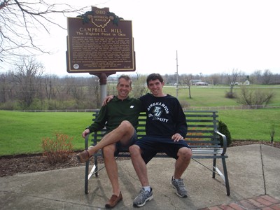
Campbell Hill
| Ohio |
Elevation: 1,550'
Vertical Gain: 50'
Vertical Gain: 50'
Date: April 23, 2011
Time: 5:40 PM
Time: 5:40 PM
Weather: Cloudy, cool
Party: Bob, Kevin
Party: Bob, Kevin
Kevin and I arrived at the Ohio Hi-Point Joint Vocational School in late afternoon after visiting
Hoosier High Point just a couple of hours earlier. We were following our itinerary exactly and
since I figured we would get here in the late afternoon, after the school's closing time, I had
called ahead for permission before we left on this trip. I'm not sure if that's why the pedestrian
gate through the chain link fence to the left of the main drive gate was left open but it did have
a chain and lock that made it seem as if it usually gets locked. The woman I talked to on the
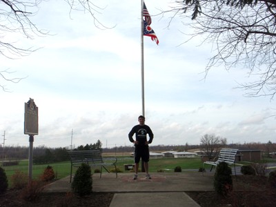
phone told me it would be open for us. You can normally drive right up to the high point
markers but we had to "hike" the few hundred yards up the road. Initially we were headed to
the wrong flag pole until we swung to the right instead, around a building, and found the
signs. There were no other highpointers signed into the log book on this day but as we were
wandering around the patio we saw the three people we met in Indiana drive into the school
grounds and walk up to join us.
This was number 8 for the trip and number 31 overall. We would stay in a hotel just past Akron
where Kevin treated me to a nice dinner at a Perkin's restaurant to celebrate our successful
trip. The next day would be Easter and we would have a long rainy drive across Pennsylvania
to meet up with relatives in New Jersey.
We put 2440.9 miles on the Rogue during 48:39 hours of driving and got a fuel economy of
27.2 mpg. We hiked a total of 62.7 miles, all in the first six days of this eight day trip.
Hoosier High Point just a couple of hours earlier. We were following our itinerary exactly and
since I figured we would get here in the late afternoon, after the school's closing time, I had
called ahead for permission before we left on this trip. I'm not sure if that's why the pedestrian
gate through the chain link fence to the left of the main drive gate was left open but it did have
a chain and lock that made it seem as if it usually gets locked. The woman I talked to on the
phone told me it would be open for us. You can normally drive right up to the high point
markers but we had to "hike" the few hundred yards up the road. Initially we were headed to
the wrong flag pole until we swung to the right instead, around a building, and found the
signs. There were no other highpointers signed into the log book on this day but as we were
wandering around the patio we saw the three people we met in Indiana drive into the school
grounds and walk up to join us.
This was number 8 for the trip and number 31 overall. We would stay in a hotel just past Akron
where Kevin treated me to a nice dinner at a Perkin's restaurant to celebrate our successful
trip. The next day would be Easter and we would have a long rainy drive across Pennsylvania
to meet up with relatives in New Jersey.
We put 2440.9 miles on the Rogue during 48:39 hours of driving and got a fuel economy of
27.2 mpg. We hiked a total of 62.7 miles, all in the first six days of this eight day trip.
This site was formerly an Air Force
Station with a cold war early warning
radar installation.
Station with a cold war early warning
radar installation.