Granite Peak
| Montana |
Elevation: 12,799'
Vertical Gain: 7,800'
Vertical Gain: 7,800'
Date: August 6, 2016
Time: 9:15 AM
Time: 9:15 AM
Weather: Cold, windy, sleeting
Party: Bob, Kevin
Party: Bob, Kevin
Kevin and I had our first real zero years - two in a row. Last year we did not plan a trip, due
mainly to both of us being busy with new jobs, Kevin with a startup and Bob with a move to
North Carolina. There may have also been a bit of psychological recovery from our first
unsuccessful attempt the year before. In 2014, we had an ambitious plan to tackle both
Gannett Peak and Granite Peak. Here is that story ...
August, 2014
Our Southwest Airlines flight on August 16 from LaGuardia arrived in Salt Lake City after a
tight connection at Chicago's Midway airport. My drivers license was lost going through
security at LaGuardia. This is, of course, a problem for travelers, yet somehow we
convinced the Hertz manager to allow our car rental. Perhaps being a good Hertz Gold
customer helped. I was still left with the concern of how we would get home. After our
usual Walmart trip for supplies we drove from Salt Lake City to Fontenelle Reservoir
campsites in Wyoming which was more than half way to the Wind River Range. This was a
self-pay, quiet place to camp.
The next morning we completed the drive to Pinedale and the Elkhardt Park trailhead at
8,800'. The hike for the day was 7.5 miles with the first five uphill and a 3:20 hike time. Our
site at Hobbs Lake at 10,127' was beautiful. The next day, Monday, had us hiking an
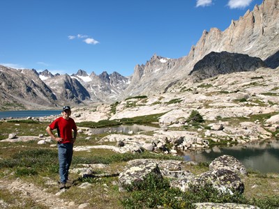
awesome but tough ten miles to Titcomb Basin above 10,000' which left us tired. Kevin did
a little fishing while we battled hoards of mosquitoes.
Tuesday was supposed to be summit day so we were up at 3:30AM and on our way at 3:50.
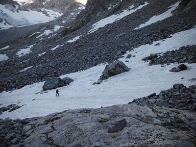
The climb to and up Bonney Pass was very tough - around, over, and under large boulders
and very steep. It took a while to figure out that strapping on the crampons and using the
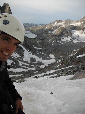
snow fields was easier. As we crested the pass the view of Gannett was both awesome and
disheartening. To nail this high point would involve a full day of descending into a valley
then doing the technical climb back up to the summit. I was already very tired but when I
saw how remote it was, with nobody else around if there was a problem, and with the
weather clearly turning worse, we had to make the tough call to turn back. By the time we
got back to the tent we had been out for eight hours and twenty minutes and only covered
probably less than two miles. I clearly underestimated this high point. After crashing in the
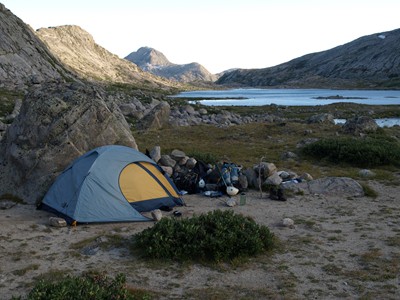
tent for a while we hiked the four miles to Island Lake. A cold rain started on the way. Hard
as it was to quit, this helped confirm that the decision was right.
At night, the temperatures reached freezing. We were both still tired during the 13 mile hike
back to the car but the last five miles were downhill so it got easier. The round trip hike
came to 37 miles. We then drove to Riverton where there were few vacancies but we did
find a room at a Motel 6.
Kevin and I still had plans for Granite. After organizing our gear, we drove to Cody where
we learned that the weather forecast was for continued very bad weather - five days of rain
and thunderstorms with snow above 7,000'. Change of plans required - Granite would have
to wait. We do not consider it an unsuccessful attempt as we never even drove to Montana.
We found the Ponderosa Campground right in Cody, went to the Buffalo Bill Museum and
the Cody Rodeo.
Our new plan was decidedly more touristy and the next day we headed towards the east
entrance of Yellowstone Park. There, we camped in the Lamar Valley at Pebble Creek, saw
two grizzlies in Hayden, drove back to Roosevelt Lodge for a four mile hike, and got caught
in a bison herd on the way back. The following morning we drove counter-clockwise
through the park seeing the main sites (for the second time in our lives), and camped near
the south entrance at Lewis Lake.
The 24th started out as a nicer weather day and Kevin and I enjoyed our drive to Jenny Lake
campground in Teton National Park. It was still early enough to get a good hike in so we
decided to do something around 10 - 15 miles. I picked a hike up Cascade Canyon towards
Lake Solitude so we headed out at about 10:45. There was not much solitude on the first
few miles of the Cascade Canyon trail with all the day hikers already out but it was pretty.
Once at Lake Solitude, the trail up and over the 10,700' Paintbrush Divide was beckoning so
we decided to continue the loop over the ridge and back around Jenny Lake. I have to
admit to a trail guide reading error that had me realizing too late that this would be a 25 mile
hike! No more time for rest stops. We pushed the pace until we popped out right at our
campsite at 8:15 with just enough time to eat and get in the tent before it was too dark and
more rain came. This was a good hike psychologically. Twenty five miles and lots of
altitude change yet we felt good. We did not come to Wyoming to attempt Gannett Peak
with a total lack of fitness.
With the remaining full day of the trip, Kevin and I drove around Teton National Park looking
for moose but saw none. After driving to the Salt Lake City Candlewood Suites, Kevin
treated me dinner at the Red Rock Brewery for a great meal. The lost drivers license did not
turn out to be a big issue at the airport. I had to go through extra security but was let
through. We put 1301 miles on the rental car and averaged 36.4 mpg. A few photos from
this trip are below. Scroll past them for the Granite entry.
mainly to both of us being busy with new jobs, Kevin with a startup and Bob with a move to
North Carolina. There may have also been a bit of psychological recovery from our first
unsuccessful attempt the year before. In 2014, we had an ambitious plan to tackle both
Gannett Peak and Granite Peak. Here is that story ...
August, 2014
Our Southwest Airlines flight on August 16 from LaGuardia arrived in Salt Lake City after a
tight connection at Chicago's Midway airport. My drivers license was lost going through
security at LaGuardia. This is, of course, a problem for travelers, yet somehow we
convinced the Hertz manager to allow our car rental. Perhaps being a good Hertz Gold
customer helped. I was still left with the concern of how we would get home. After our
usual Walmart trip for supplies we drove from Salt Lake City to Fontenelle Reservoir
campsites in Wyoming which was more than half way to the Wind River Range. This was a
self-pay, quiet place to camp.
The next morning we completed the drive to Pinedale and the Elkhardt Park trailhead at
8,800'. The hike for the day was 7.5 miles with the first five uphill and a 3:20 hike time. Our
site at Hobbs Lake at 10,127' was beautiful. The next day, Monday, had us hiking an
awesome but tough ten miles to Titcomb Basin above 10,000' which left us tired. Kevin did
a little fishing while we battled hoards of mosquitoes.
Tuesday was supposed to be summit day so we were up at 3:30AM and on our way at 3:50.
The climb to and up Bonney Pass was very tough - around, over, and under large boulders
and very steep. It took a while to figure out that strapping on the crampons and using the
snow fields was easier. As we crested the pass the view of Gannett was both awesome and
disheartening. To nail this high point would involve a full day of descending into a valley
then doing the technical climb back up to the summit. I was already very tired but when I
saw how remote it was, with nobody else around if there was a problem, and with the
weather clearly turning worse, we had to make the tough call to turn back. By the time we
got back to the tent we had been out for eight hours and twenty minutes and only covered
probably less than two miles. I clearly underestimated this high point. After crashing in the
tent for a while we hiked the four miles to Island Lake. A cold rain started on the way. Hard
as it was to quit, this helped confirm that the decision was right.
At night, the temperatures reached freezing. We were both still tired during the 13 mile hike
back to the car but the last five miles were downhill so it got easier. The round trip hike
came to 37 miles. We then drove to Riverton where there were few vacancies but we did
find a room at a Motel 6.
Kevin and I still had plans for Granite. After organizing our gear, we drove to Cody where
we learned that the weather forecast was for continued very bad weather - five days of rain
and thunderstorms with snow above 7,000'. Change of plans required - Granite would have
to wait. We do not consider it an unsuccessful attempt as we never even drove to Montana.
We found the Ponderosa Campground right in Cody, went to the Buffalo Bill Museum and
the Cody Rodeo.
Our new plan was decidedly more touristy and the next day we headed towards the east
entrance of Yellowstone Park. There, we camped in the Lamar Valley at Pebble Creek, saw
two grizzlies in Hayden, drove back to Roosevelt Lodge for a four mile hike, and got caught
in a bison herd on the way back. The following morning we drove counter-clockwise
through the park seeing the main sites (for the second time in our lives), and camped near
the south entrance at Lewis Lake.
The 24th started out as a nicer weather day and Kevin and I enjoyed our drive to Jenny Lake
campground in Teton National Park. It was still early enough to get a good hike in so we
decided to do something around 10 - 15 miles. I picked a hike up Cascade Canyon towards
Lake Solitude so we headed out at about 10:45. There was not much solitude on the first
few miles of the Cascade Canyon trail with all the day hikers already out but it was pretty.
Once at Lake Solitude, the trail up and over the 10,700' Paintbrush Divide was beckoning so
we decided to continue the loop over the ridge and back around Jenny Lake. I have to
admit to a trail guide reading error that had me realizing too late that this would be a 25 mile
hike! No more time for rest stops. We pushed the pace until we popped out right at our
campsite at 8:15 with just enough time to eat and get in the tent before it was too dark and
more rain came. This was a good hike psychologically. Twenty five miles and lots of
altitude change yet we felt good. We did not come to Wyoming to attempt Gannett Peak
with a total lack of fitness.
With the remaining full day of the trip, Kevin and I drove around Teton National Park looking
for moose but saw none. After driving to the Salt Lake City Candlewood Suites, Kevin
treated me dinner at the Red Rock Brewery for a great meal. The lost drivers license did not
turn out to be a big issue at the airport. I had to go through extra security but was let
through. We put 1301 miles on the rental car and averaged 36.4 mpg. A few photos from
this trip are below. Scroll past them for the Granite entry.
Awesome day 1 scenery.
August, 2016
After the overly ambitious 2014 agenda, Kevin and I decided to focus on only one big
mountain this year - the imposing Granite Peak in Montana. We knew if we can tackle that one,
we would still be in the game. Since I was coming from North Carolina and Kevin from New
York, we flew separately and met up in Billings. It worked out well. I had a late afternoon flight
from Raleigh through Denver and Kevin flew from LaGuardia through Chicago. I had time to
rent a nice Buick Lacrosse from Hertz before Kevin arrived only an hour later. We stayed at
the Riverside Inn.
In the morning of August 4th, we food shopped at an Albertson's then went looking for stove
fuel at Cabela's. They had none but luckily we found a canister at the Basecamp store. By the
time we drove to the trailhead near the Mystic Lake hydroelectric plant (about 18 miles from
Fishtail) and started hiking, it was 4:00. We put in at least 3 miles, hiking past Mystic Lake to
the junction of Phantom Creek where we camped and enjoyed a campfire.
The next day was a tough one, hiking over 3,500' vertical feet up Phantom Creek to the Froze
to Death Plateau. By 2:00 we found a spot near Mt. Tempest about a quarter of a mile from the
ridge that drops to the saddle between Tempest and Granite. We could see other tents up at
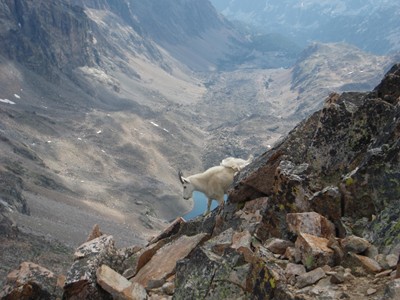
the ridgeline. I was exhausted and happy that Kevin volunteered to get water. Several
mountain goats came to pay us a visit. From the campsite to the Froze to Death Plateau is 3.1
miles and then another 5.0 miles following cairns to our camp site.
August 6th, up at 4:15 for summit day! We could see headlights from the other campers up on
the edge of the saddle. We decided to bring our full packs to the bottom of the saddle to
return by the Avalanche Lake route. More on the wisdom of this decision later. We were
packed up at 4:45 and hiking in the dark up to the edge of the bowl. The terrain was rocky and
tough on the traverse down to the center of the saddle which we reached about 6:00. There,
we cached our big packs. The route finding was difficult after this. Fortunately the snow
bridge was an easy dirt crossing. At one point I climbed a chute that got too difficult and I had
to down climb. There were a few groups ahead of us. About five who reached the summit
before us and one who turned back. There was another party of three just below the summit. I
suspect there were no others this day. When we got within a few meters of the summit
boulder we circled around to the north side and suddenly got blasted with cold windy sleet.
This was about 9:15 AM. We had no interest in hanging out there. There was little visibility
and we only stayed about the minute it took to snap a few pictures. I was nervous about the
decent in bad weather and wanted to get out of the cold wind. We even skipped signing the
register. I later wished we signed it and had a few more photos.
Kevin and I saw no other people this day, likely due to the worsening weather. Route finding
was difficult on the way down too. We had trouble finding the "notch" and ended up coming
down a slightly different way. There ended up being five rappel pitches which was at least one
more than expected. Thankfully we did not rappel down to an area we could not get out of. To
my dismay, I discovered that I left the slings in the big pack but fortunately there were enough
left on the mountain by previous climbers that looked pretty new.
The slog down to Avalanche Lake was long, rocky, and tedious. It was hard to find the best
way through the wet boulder fields and I even fell a few times with the heavy pack. We were
happy to find a nice campsite at the end of the lake at about 6:00 after a 13 hour day. Kevin
slept for two hours. I was again glad he volunteered to get water as I was too tired to walk the
50 meters to the lake. We had one more nosy goat visit us. A few big bangs of thunder up
above had us glad we were not up on the Froze to Death Plateau where it seemed to be
happening. It was a surprisingly warm night.
After two exhausting days we thought the next one would be easy but it was not to be. Lots of
boulder fields! We just took it one lake at a time. Many downed trees and the rock fields made
the trail hard to follow, especially by Huckleberry Lake. It was good to finally find the actual
trail to Mystic Lake. There was off and on rain including one close lightning strike near Mystic
Lake. Once reaching Mystic Lake, it still felt like a long trudge back to the car. Since we left
camp about 8:30 and reached the car about 3:30, it was a seven hour day to cover the eight or
nine miles. I picked this return route mainly for a change in scenery which was awesome. It
may have worked out for us to get to lower elevations quicker due to the weather but I would
not otherwise recommend it if reaching the summit the easiest way is the main goal.
We had chatted with a small group of climbers just starting up the trail who were enthusiastic
about hearing of our success. This helped remind us to savor it and celebrate. We enjoyed
pizza in Columbus and stayed the night at Spring Creek campground in Big Timber.
It was nice to have a couple of reserve days free to sight see. On the 8th, we took a drive
through Jefferson National Forest and toured the Lewis and Clark cavern. Then, back to the
Spring Creek campground. The next day took us to the Custer Battlefield where the ranger at
the entrance station informed us of two helicopter rescues that just happened on Granite.
(Sadly, the son in another father-son team would eventually succumb to a head injury from a
fall. This hit home for me.) Back at the Riversage Billings Inn, Kevin found the Uber Brew for
great burgers and beer.
It was an early rise to get to the airport. Kevin and I had the same leg to Denver where we
parted ways.
The total hike length was 23 miles with a 6600' elevation gain. We put 803 miles on the Buick
Lacrosse and averaged 26.2 mpg.
After the overly ambitious 2014 agenda, Kevin and I decided to focus on only one big
mountain this year - the imposing Granite Peak in Montana. We knew if we can tackle that one,
we would still be in the game. Since I was coming from North Carolina and Kevin from New
York, we flew separately and met up in Billings. It worked out well. I had a late afternoon flight
from Raleigh through Denver and Kevin flew from LaGuardia through Chicago. I had time to
rent a nice Buick Lacrosse from Hertz before Kevin arrived only an hour later. We stayed at
the Riverside Inn.
In the morning of August 4th, we food shopped at an Albertson's then went looking for stove
fuel at Cabela's. They had none but luckily we found a canister at the Basecamp store. By the
time we drove to the trailhead near the Mystic Lake hydroelectric plant (about 18 miles from
Fishtail) and started hiking, it was 4:00. We put in at least 3 miles, hiking past Mystic Lake to
the junction of Phantom Creek where we camped and enjoyed a campfire.
The next day was a tough one, hiking over 3,500' vertical feet up Phantom Creek to the Froze
to Death Plateau. By 2:00 we found a spot near Mt. Tempest about a quarter of a mile from the
ridge that drops to the saddle between Tempest and Granite. We could see other tents up at
the ridgeline. I was exhausted and happy that Kevin volunteered to get water. Several
mountain goats came to pay us a visit. From the campsite to the Froze to Death Plateau is 3.1
miles and then another 5.0 miles following cairns to our camp site.
August 6th, up at 4:15 for summit day! We could see headlights from the other campers up on
the edge of the saddle. We decided to bring our full packs to the bottom of the saddle to
return by the Avalanche Lake route. More on the wisdom of this decision later. We were
packed up at 4:45 and hiking in the dark up to the edge of the bowl. The terrain was rocky and
tough on the traverse down to the center of the saddle which we reached about 6:00. There,
we cached our big packs. The route finding was difficult after this. Fortunately the snow
bridge was an easy dirt crossing. At one point I climbed a chute that got too difficult and I had
to down climb. There were a few groups ahead of us. About five who reached the summit
before us and one who turned back. There was another party of three just below the summit. I
suspect there were no others this day. When we got within a few meters of the summit
boulder we circled around to the north side and suddenly got blasted with cold windy sleet.
This was about 9:15 AM. We had no interest in hanging out there. There was little visibility
and we only stayed about the minute it took to snap a few pictures. I was nervous about the
decent in bad weather and wanted to get out of the cold wind. We even skipped signing the
register. I later wished we signed it and had a few more photos.
Kevin and I saw no other people this day, likely due to the worsening weather. Route finding
was difficult on the way down too. We had trouble finding the "notch" and ended up coming
down a slightly different way. There ended up being five rappel pitches which was at least one
more than expected. Thankfully we did not rappel down to an area we could not get out of. To
my dismay, I discovered that I left the slings in the big pack but fortunately there were enough
left on the mountain by previous climbers that looked pretty new.
The slog down to Avalanche Lake was long, rocky, and tedious. It was hard to find the best
way through the wet boulder fields and I even fell a few times with the heavy pack. We were
happy to find a nice campsite at the end of the lake at about 6:00 after a 13 hour day. Kevin
slept for two hours. I was again glad he volunteered to get water as I was too tired to walk the
50 meters to the lake. We had one more nosy goat visit us. A few big bangs of thunder up
above had us glad we were not up on the Froze to Death Plateau where it seemed to be
happening. It was a surprisingly warm night.
After two exhausting days we thought the next one would be easy but it was not to be. Lots of
boulder fields! We just took it one lake at a time. Many downed trees and the rock fields made
the trail hard to follow, especially by Huckleberry Lake. It was good to finally find the actual
trail to Mystic Lake. There was off and on rain including one close lightning strike near Mystic
Lake. Once reaching Mystic Lake, it still felt like a long trudge back to the car. Since we left
camp about 8:30 and reached the car about 3:30, it was a seven hour day to cover the eight or
nine miles. I picked this return route mainly for a change in scenery which was awesome. It
may have worked out for us to get to lower elevations quicker due to the weather but I would
not otherwise recommend it if reaching the summit the easiest way is the main goal.
We had chatted with a small group of climbers just starting up the trail who were enthusiastic
about hearing of our success. This helped remind us to savor it and celebrate. We enjoyed
pizza in Columbus and stayed the night at Spring Creek campground in Big Timber.
It was nice to have a couple of reserve days free to sight see. On the 8th, we took a drive
through Jefferson National Forest and toured the Lewis and Clark cavern. Then, back to the
Spring Creek campground. The next day took us to the Custer Battlefield where the ranger at
the entrance station informed us of two helicopter rescues that just happened on Granite.
(Sadly, the son in another father-son team would eventually succumb to a head injury from a
fall. This hit home for me.) Back at the Riversage Billings Inn, Kevin found the Uber Brew for
great burgers and beer.
It was an early rise to get to the airport. Kevin and I had the same leg to Denver where we
parted ways.
The total hike length was 23 miles with a 6600' elevation gain. We put 803 miles on the Buick
Lacrosse and averaged 26.2 mpg.
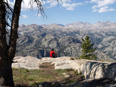
All uphill to this rewarding view at
Photographers Point on day 1.
Photographers Point on day 1.
Hobbs Lake.
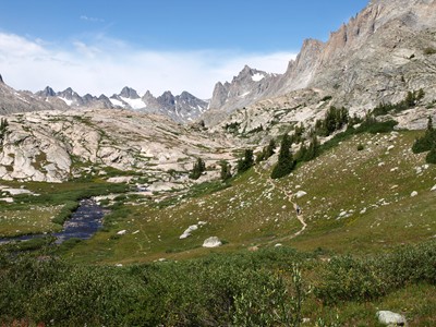
Entering Titcomb Basin with the
first site of Bonney Pass in the
distant center.
Below - In Titcomb Basin.
first site of Bonney Pass in the
distant center.
Below - In Titcomb Basin.
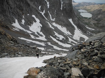
Heading up Bonney Pass.
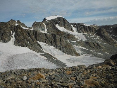
Our first good look at Granite as
we approach the top of Bonney
Pass and ...
we approach the top of Bonney
Pass and ...
... the realization of how much
climbing and how much further we
have to go sinks in.
climbing and how much further we
have to go sinks in.
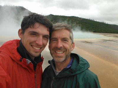
Change of plans ... Yellowstone!
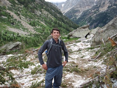
Avalanche debris in the Tetons on
the way to Lake Solitude.
the way to Lake Solitude.
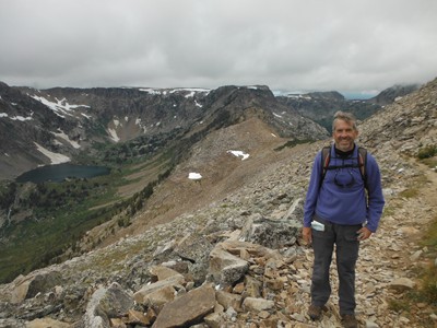
Up and over Paintbrush Divide
with Lake Solitude in the
background.
with Lake Solitude in the
background.
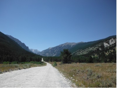
The approach to the trailhead.
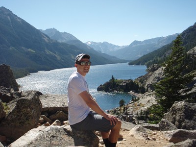
Beautiful Mystic Lake.
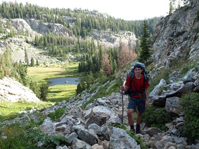
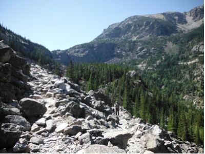
This was still an "easy" section
on the way to the lake.
on the way to the lake.
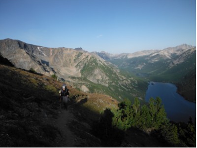
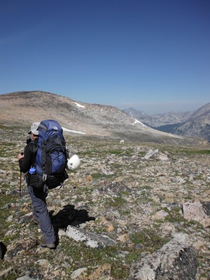
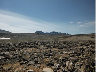
Day 2 - Ascending the Phantom
Creek trail to the Froze to Death
Plateau.
Creek trail to the Froze to Death
Plateau.
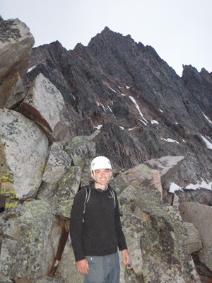
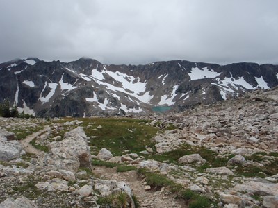
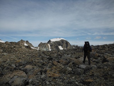
The plateau and our first
glimpse of Granite Peak.
glimpse of Granite Peak.
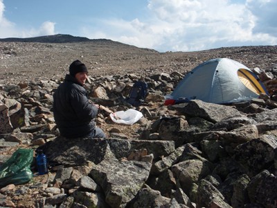
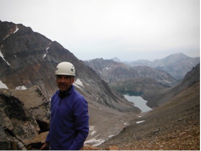
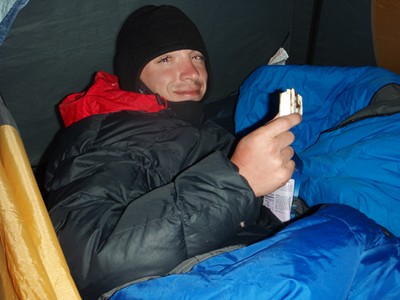
Kevin is cold but thankfully
not quite freezing to death.
not quite freezing to death.
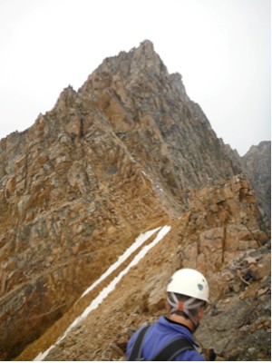
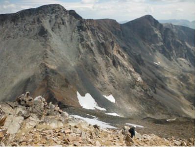
These are from the saddle
where we stashed our large
packs.
where we stashed our large
packs.
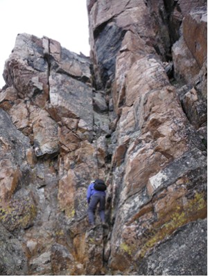
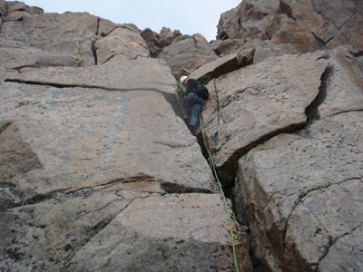
Working our way to the barely
there "snow bridge" and Bob
climbing the first chimney
after it.
there "snow bridge" and Bob
climbing the first chimney
after it.
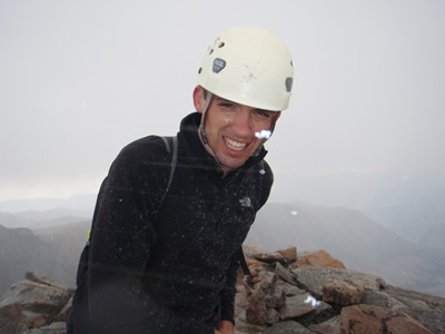
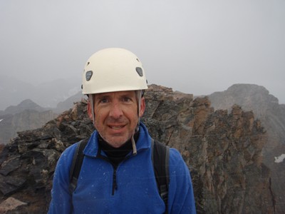
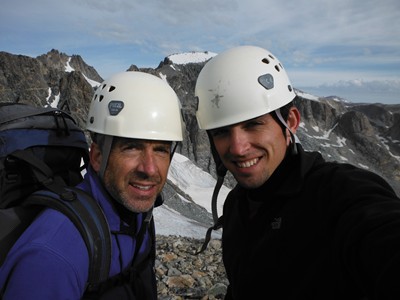
Yes, these are the best summit
photos we have. Stay much
longer and we will freeze to
death.
photos we have. Stay much
longer and we will freeze to
death.
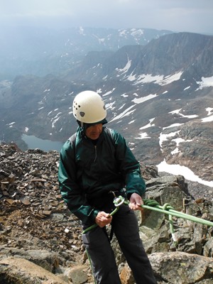
A couple of the rappels on the
decent.
decent.
I love this goat shot.
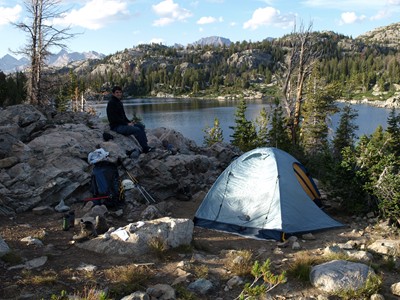
A well deserved nap after a
long, hard, but rewarding day.
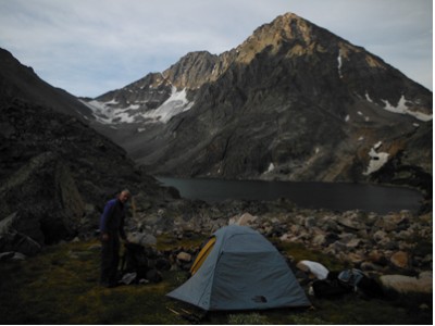
So glad to find this spot to
pitch a tent at Avalanche Lake.
long, hard, but rewarding day.
So glad to find this spot to
pitch a tent at Avalanche Lake.