
Gannett Peak
| Wyoming |
Elevation: 13,804'
Vertical Gain: 10,750'
Vertical Gain: 10,750'
Date: July 20, 2019
Time: 11:02 AM
Time: 11:02 AM
Weather: Cool, nice
Party: Bob, Kevin
Party: Bob, Kevin
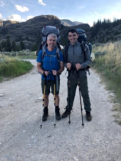
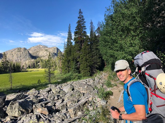
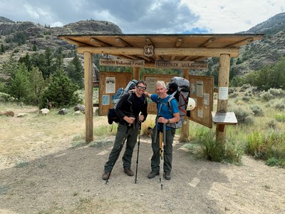
Ready to go! (Clean, energetic, not
bug bitten, and no blisters.)
bug bitten, and no blisters.)
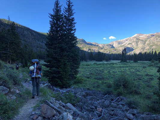
Early morning,
day two.
day two.
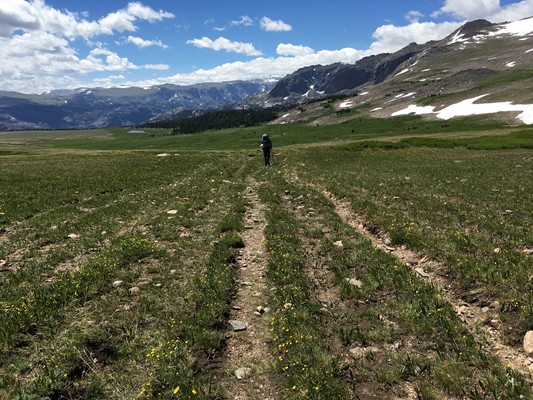
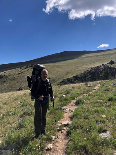
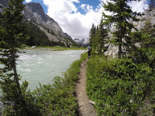
The long
Burro Flat.
Burro Flat.
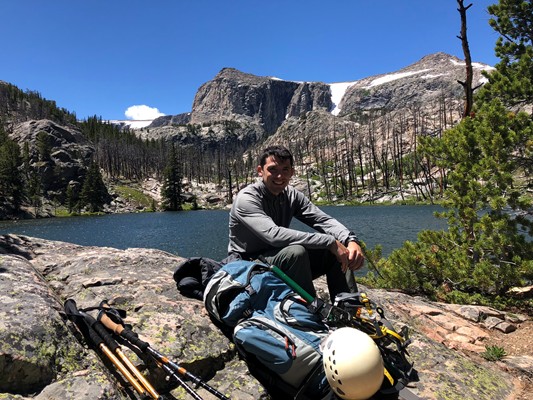
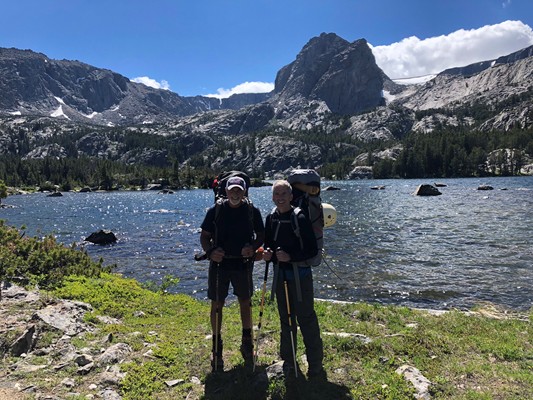
Kevin at pretty
Double Lake and
Don and I at Star
Lake.
Double Lake and
Don and I at Star
Lake.
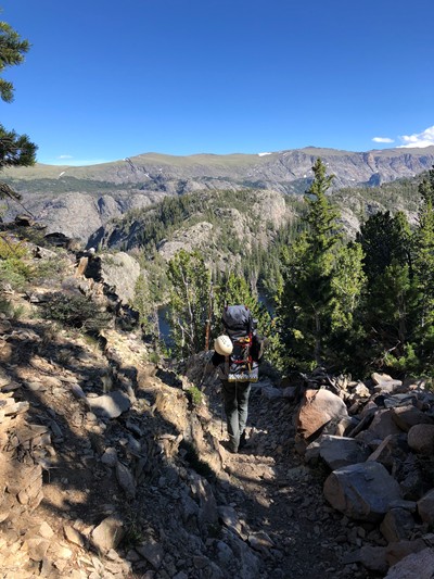
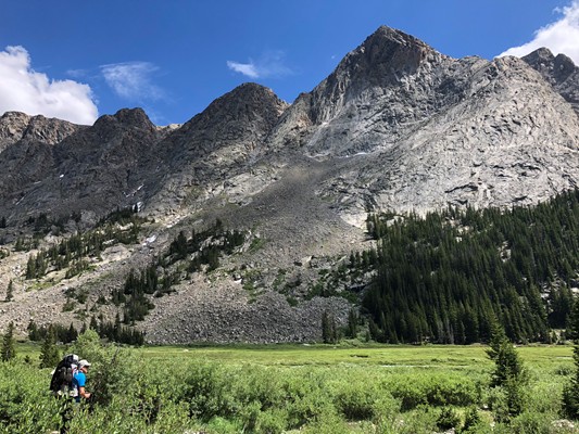
What goes up must come down.
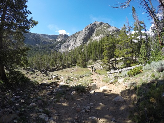
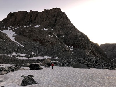
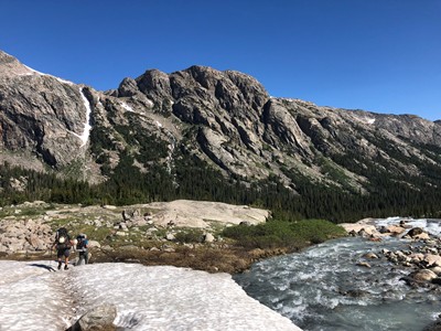
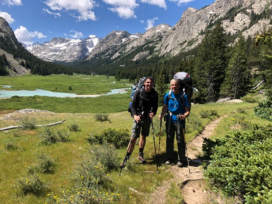
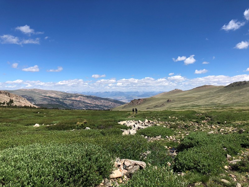
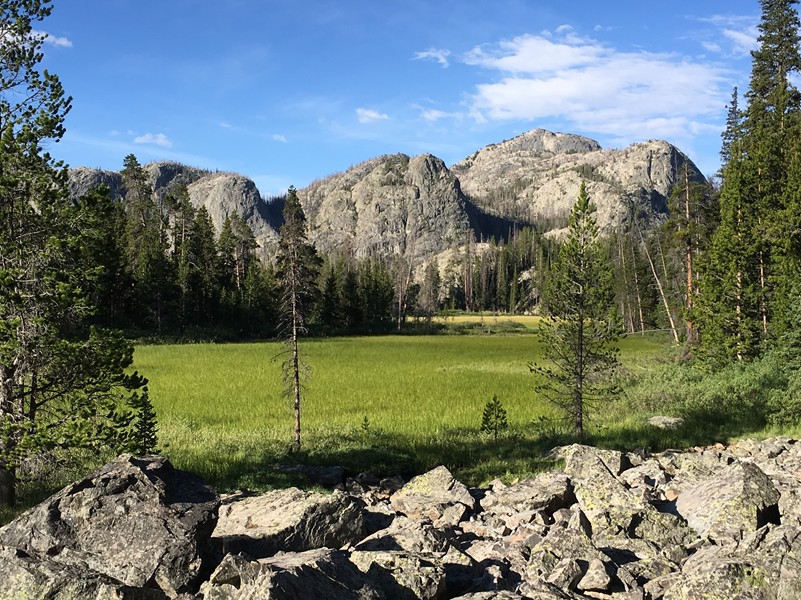
Awesome meadows
as we head up the
valley to the base of
Gannett.
as we head up the
valley to the base of
Gannett.
Dinwoody "Creek"
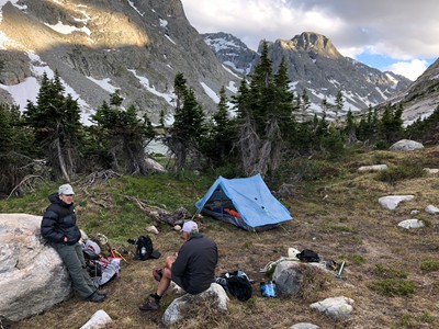
Bob and Don at base camp.
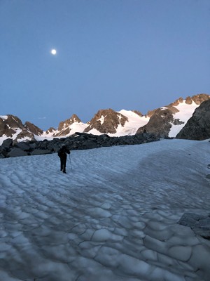
On our way. This is after the tarn boulder
field as we start up the mountain. The
moon was bright and the sun is coming up.
field as we start up the mountain. The
moon was bright and the sun is coming up.
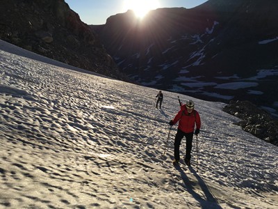
Don and Kevin.
Bob - Crampons on and
looking for the next snow field.
looking for the next snow field.
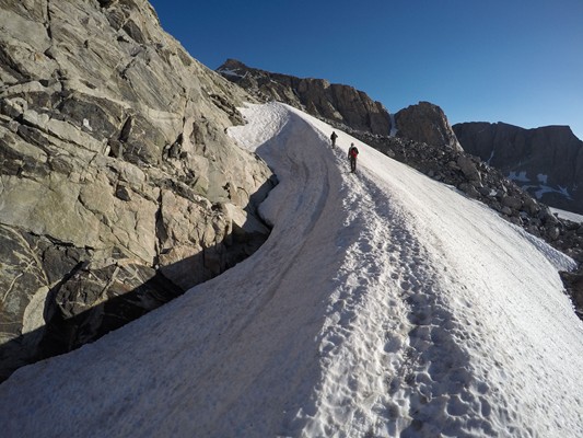
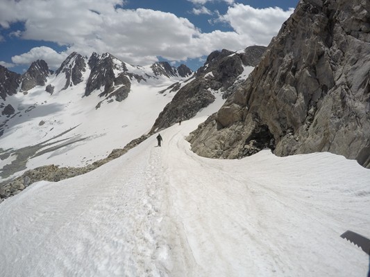
The switchback
heading towards
where we crossed
over Gooseneck
Ridge.
heading towards
where we crossed
over Gooseneck
Ridge.
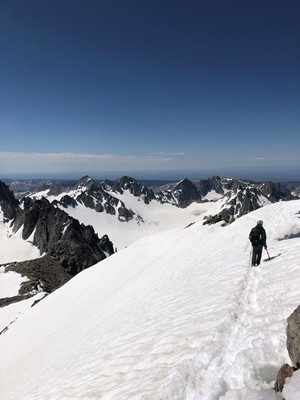
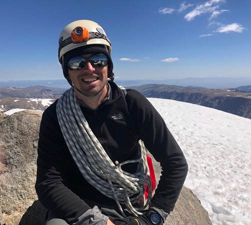
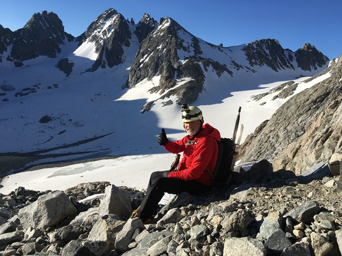
Thumbs up from Don for this moment to be in this beautiful spot in the world.
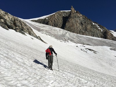
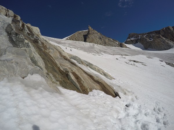
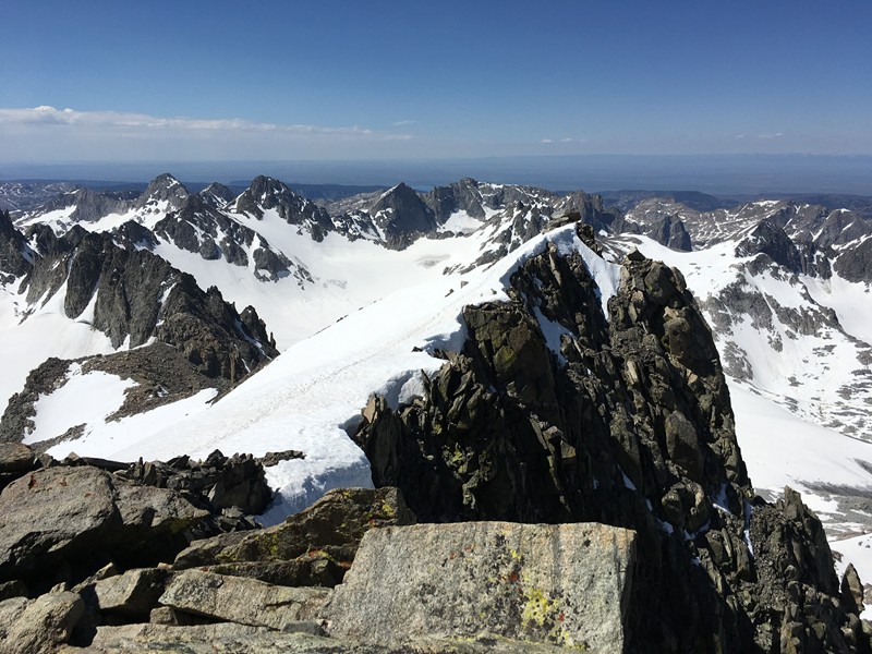
Heading up Gooseneck Glacier. I
believe that is the West Sentinel
ahead. We will turn left at that next
rock outcrop.
believe that is the West Sentinel
ahead. We will turn left at that next
rock outcrop.
Below is Don's view of Kevin and
Bob from the rock outcrop ...
Bob from the rock outcrop ...
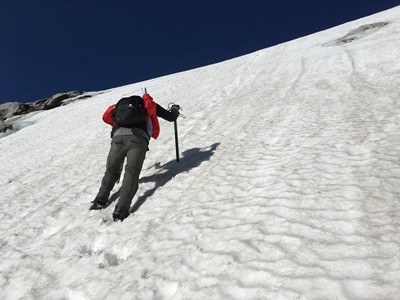
... and this is Bob's view of
Kevin doing the work of kicking
steps as it gets progressively
steeper.
Kevin doing the work of kicking
steps as it gets progressively
steeper.
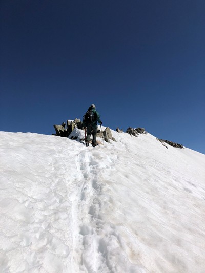
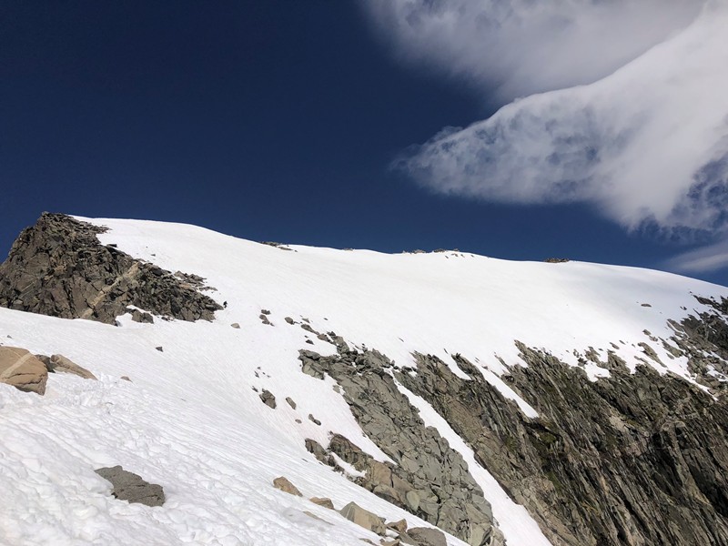
Bob reaching the top of the
summit ridge.
summit ridge.
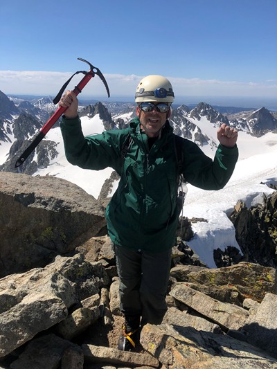
We did it!
We came from that direction!
Time to head back down the summit ridge.
Stay away from the cliffs but not too far left!
Stay away from the cliffs but not too far left!
Can you spot me in the photo
below? (Near the narrow section.)
below? (Near the narrow section.)
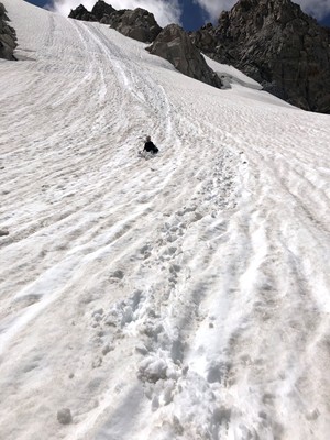
Fun to do a little glissading.
Within a couple of weeks the
bergschrund just above me will
be fully open.
Within a couple of weeks the
bergschrund just above me will
be fully open.
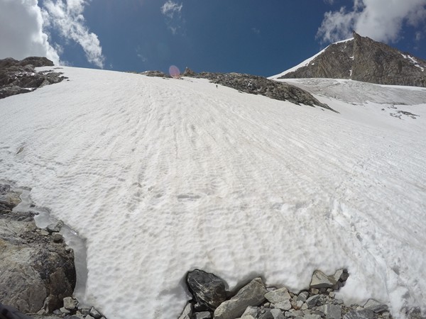
I'm so far behind Kevin I'm just a spec again.
This is where we met back up with Don. I think
we came down a slightly different way.
This is where we met back up with Don. I think
we came down a slightly different way.
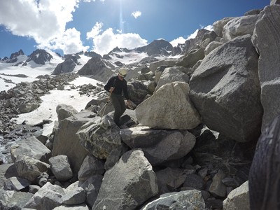
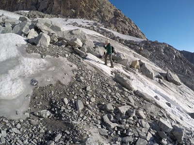
The last boulder field then over
a mile to base camp.
a mile to base camp.
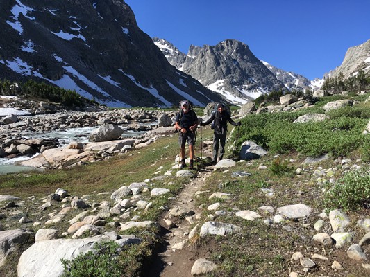
On our way home!
Dirty, tired, bug bitten, and blistery ... but happy!
The second time is a charm! I was a little anxious about trying Gannett again after our 2014
attempt and the difficult Granite Peak climb in 2016. (See the previous write-up on Granite
Peak for a description of the first Gannett attempt.) My thoughts were along the lines of doing
Mt. Rainier with a guide so that we could say we at least attempted all 48. Kevin wanted to try
Gannett again. It took a couple of years to get the drive back up and find the time for each of
us to be able to take a week off for this trip. I also had to contend with a couple of pesky
diagnoses - of prostate cancer and Parkinson's Disease. Now, at age 57 and five years after
our first attempt, I knew that we would have to do things a little different. We would leave extra
days in case we had to wait for better weather, we would go a little earlier in the season and
take advantage of the easier walking on snow fields rather than boulder fields, and we would
not underestimate the climb. (We still did.) Reading that the eastern approach should result in
an easier summit day boosted my optimism and my excitement about seeing some awesome
new scenery. Another change we made was to invite my friend and neighbor, Don, along with
us. His hiking and climbing experience, gratitude, strength, and great attitude would become
huge factors in making this trip such a positive experience overall.
It seems like a lot more planning went into this trip than the others. I spent a lot of time trying
to lighten the pack. I invested in a lightweight ZPacks Duplex tent and with Pam's prodding, I
upgraded my North Face Rainier pack to an Osprey Aether Pro 70. For training, it was too hot
to build up my runs to over ten miles as I planned so I ended up mixing core strength with
aerobic workouts like the elliptical, cycling, and swimming. I'll admit to one stairwell climb
workout in my new office building that left me panting and sweaty in the next meeting. I also
got in a three day warm-up backpacking trip in Virginia with Steve, a friend from work. This
came with a near "gimme" of a second visit to the summit of Mt. Rogers which was only a half
mile up a side trail off the AT.
On Wednesday, July 17, Don, Kevin, and I got together at the Denver airport. Don arrived a
day earlier and met me at the Hertz counter where he had picked out a Chevy Equinox for us.
We had time for a Dunkin coffee before heading back to the terminal to pick up Kevin. It was
still only 8:30AM but we had a long drive ahead of us. Salt Lake City or Jackson Hole
would've been closer but they required multiple flights and the flight times were not as
convenient. We made a stop at Walmart in Fort Collins for stove fuel and a few other items.
Lunch was in Laramie at McCallister's Deli and dinner was at a Safeway in Lander. We finally
turned off the main roads just before Dubois at about 5:30PM and decided we could still get a
few miles in. Our official pack "weigh-in" after organizing our gear at a primitive camping area
near the trailhead resulted in moving about six pounds of climbing protection gear from Don
to Kevin. (Later, Don and I agreed that we should've given him more to slow him down.) Even
after this, Don was close to 60 pounds, Kevin had 44, and my pack was a meager 42 pounds.
Our hike started at 7:19PM at 7600' and we hiked about 2.5 miles when we found a nice spot
to camp right off the trail.
We were up at 5:30, maybe a little jet lagged, an on the trail at 7:30. In a short time we found
ourselves climbing 29 switchbacks, going from 8,600' to nearly 10,000' in a short distance.
This was followed by a slow, deceiving hike up to 10,895' in the wide open Burro Flat. We
would then lose much of that altitude on our way to Double Lake where we had a late lunch. It
was a more tiring day than expected but we enjoyed the diverse scenery. There were few
people on the trail but we did talk with one party that summited and told us it was windy for
them but the snow conditions were good (delighted to hear), however, another told us about
a helicopter rescue they helped with the day before (concerned to hear). It was for a man who
fell in a rocky area near the summit and possibly broke his arm. This was a reminder that even
a twisted ankle would be serious this far from civilization. We stopped hiking at 6:00, tired and
sore, and were in the tent at 8:00. We should have about nine miles left of the 22 mile
approach.
Friday was supposed to be easier! It was a long slog up the valley that sure seemed longer
than nine miles. The 20 or so stream crossings did not help, particularly the three or four that
were raging rivers. Kevin and Don helped me scout out the best path over some of the log
and stone crossings that required a bit of balance. A few times, Kevin would even come back
across to take my pack over for me. For one large creek we received some advice earlier from
some young women to cross where the horses cross. Made sense, only it resulted in Kevin
quickly finding himself in a powerful, waist deep current. With a little more scouting, we found
out the footbridge that was supposed to be out was still half intact and was an easier
crossing spot.
The views in this valley were incredible and we had our first look at Gannett in the afternoon.
We stopped at 6:00 a little after the first snow fields and about a mile or mile anda half from the
start of the tarn boulder field at the base of Gannett. The weather was still excellent, the
breezes that would cause tent flapping all night were supposed to calm down, and as far as
we knew, the next day still had the best weather forecast. So no rest day ... we were on! Kevin
gave a "boots on at 3:00AM" order so we were in our tents at 8:00.
Up at 2:45AM on Saturday to a beautiful sky, calmed winds, and a nearly full moon. Started
out at 3:20 on relatively flat ground that was not too hard to navigate in the dark. It was
already getting lighter as we started upwards, alternating between rock fields and snow fields.
At one stop to put on the crampons, we heard a rock drop due to the sunlight hitting and
warming the top of a cliff above us. After what seemed like too long of a pause of silence a
suitcase sized boulder started bouncing its way towards us. I was ready to jump out of the
way and Kevin was ready to push me but I didn't know which way to jump as the boulder
bounced erratically towards us. Fortunately, it ended up stopping thirty feet or so away.
The GPS was needed more than I expected and I'm still not totally sure if we took the most
efficient route. There was a long switchback on a snow field back to the northeast to cross
over Gooseneck Ridge and then a turn to the west to head up Gooseneck Glacier. It got
progressively steeper but we just kicked steps and did not feel the need to rope up. Don
decided to leave the summit to us and wait for our return in this stretch before the Gooseneck
Pinnacle and Kevin and I continued on. From there it was much longer than expected to the
summit and back. We were very deliberate about planting the ice axe with each step and it
took strangely long to put the crampons back on carefully after a rock section. The
bergschrund was not open and not a problem but the large rock field before the final snow
ascent to the summit ridge slowed us. It was 10:00 and we paused to have a discussion about
turning back due to the relatively warm conditions and softening snow. We could see the
summit and it looked close but we correctly guessed it was still an hour away. The skies
looked good and we would be off the summit well before noon. It doesn't get much better so
were good to go. The softening snow actually gave us more confidence on the summit ridge
and again we felt comfortable enough to forgo the rope.
A beautiful summit! There was only a little wind and I'm guessing it was about 50 degrees. We
made sure to take our hero shots and sign the register. There were no entries from earlier in
the day and we did not see anyone else on the mountain all day. After only 15 minutes the
thoughts of the task still ahead of us of getting down safely and the distance yet to cover
prompted us to head down at 11:18.
At about 2:00PM I was happy to hear Kevin yelling from up ahead of me that he sees Don
down below. I was shocked to hear that he had to wait six hours for us and was starting to
worry. The time went so fast. Thankfully he knew it could take a while and he did not activate
his SPOT satellite messenger to scramble the choppers! We still had a long way back to our
little base camp at 10,600' and it ended up being a 14 hour day.
I finally slept well! I was not up until 8:00AM after 12 hours of sleep but was still not feeling
recovered on the return hike and lagged behind Don and Kevin. Without the wind, the
mosquitoes were fierce and I knew they would not be camping our extra night. We covered
maybe ten miles to Star Lake where we camped and covered another dozen on Monday to get
to the trailhead. The stream crossings were a little easier since we had them scouted out
already but I remained on autopilot the whole way and plodded extra slow on the uphills. I
was impressed with ourselves that we actually hiked this trail on the way to Gannett with all
the ups and downs, the rockiness of it, the river crossings, and that we climbed up all those
switchbacks. In my fatigue-induced stupor on Burro Flat I did have one trip and fall that left
me with a bloody face which looked worse than it was.
Our 50 mile round trip finished at 4:30 with thunderstorm threats and high fives. We drove to
Lander and enjoyed a nice pizza meal. We were lucky to find available rooms in a hotel there.
The next day, Tuesday the 23rd, we finished the drive to Denver where Kevin treated Don and
I to bison burgers at a nearby brewery. Kevin and I were also fortunate enough to be able to
meet up with my nephew, Mike, and meet his new fiancee, Rissa, at a beer garden, and Don
was kind enough to share his hotel room despite our coming in late and getting up early for
the flights back.
It is hard to compare the difficulty of the different high points as there are many factors such
as personal fitness and health, weather, route selection, acclimatization, and climbing
conditions. We had good weather and good conditions for Gannett but we both still think it
was the hardest so far due to the cumulative effects of multiple hard days on the long
approach. Granite Peak was also hard but I think it could have been made easier with better
route finding at the top, a different route down, and another day added. I found Kings Peak to
be my third toughest but we were going up and down to avoid snow fields and rain and sleet
left the rocky mountainside slick. I suspect Mt. Rainier would be much easier in good weather
with a three day ascent instead of two days which is commonly done.