
Mount Mansfield
| Vermont |
Elevation: 4,393'
Vertical Gain: 2,800'
Vertical Gain: 2,800'
Date: June 29, 2006
Time: 1:10 PM
Time: 1:10 PM
Weather: Hazy
Party: Bob, Kevin
Party: Bob, Kevin
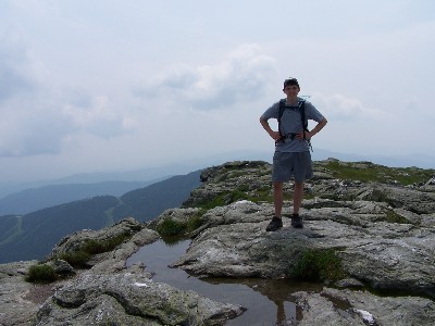
It took Kevin and I two or three tries to find the right parking lot on Rt 108 in Smuggler's Notch
after our drive from Gorham, NH. We started hiking about 11:35 and immediately started
ascending steadily on the Long Trail southbound. The views were hazy but good and we had
the exposed peak to ourselves. Our return route was a loop back on the Profanity Trail (named
by someone going up it, no doubt) back to the Long Trail for a total of 4.7 miles in about three
hours. After the hike we headed off through Burlington to the Adirondack Loj in New York.
Mt Mansfield looks like a face profile from the east with the peak being the chin. There is an
auto road to the ski area summit station at the nose and from there it would've required only a
little more than 300 feet of vertical gain to reach the summit. Of course, taking the auto road is
against our personal rules for highpointing so it was not an option.
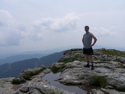
Looking south from the top of
Mansfield. The Stowe ski trails
can be seen in the background.
Mansfield. The Stowe ski trails
can be seen in the background.