
Mount Washington
| New Hampshire |
Elevation: 6,288'
Vertical Gain: 4,270'
Vertical Gain: 4,270'
Date: June 28, 2006
Time: 10:05 AM
Time: 10:05 AM
Weather: Cold, windy, rainy
Party: Bob, Kevin
Party: Bob, Kevin
A day of leisurely driving from Baxter State Park to Moose Brook State Park in Gorham, NY left
us ready to climb the highest peak in the Northeast. This would actually be Kevin's second
time up (he was too young to remember the first very well) and my sixth time. I had previously
taken the cog railway, hiked it, biked it, drove it, and ran it. The weather wasn't promising so
Kevin and I got an early start, leaving from Pinkham Notch at 7:05 and taking the awesome
Tuckerman Ravine trail up the headwall. We were basically alone on this route, probably since
signs at the base implied it was closed due to rockfall danger but we inquired with the ranger
at the Hermit Lake station who said it had just opened and that it was now safe.
The weather at the top was typical for this time of year on Mt Washington with a temperature of
49 degrees and 30 mph winds. This was actually not too bad for a mountain with a yearly
average of 27 degrees and 35 mph winds and where the world's highest recorded wind speed
of 231 mph occurred in 1934. We had an early lunch in the summit lodge, took a quick browse
around, and checked the display listing all the fatalities on the mountain as I always do.
Although we didn't plan on staying too long because of the uncertain weather, it was already
pouring by the time we were ready to leave. We took the Boott Spur trail back around the
south side of Tuckerman Ravine for a change of scenery and the rain stayed with us the whole
way. Picking up that raincoat at L. L. Bean a few days ago was a lifesaver!
We covered about 9.5 miles in 6.5 hours of hiking time. Advantages of Gorham over Baxter
were the laundromat which returned our clothes to the preferred warm and dry state, and the
Pizza Hut where we satisfied our large appetites. Fortunately the rain subsided for our evening
back at Moose Brook.
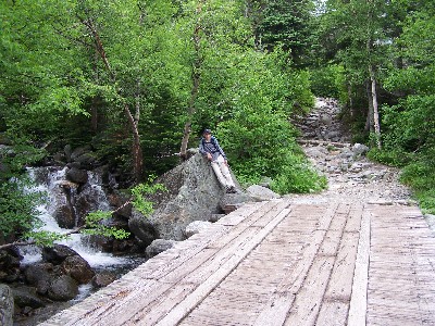
The Tuckerman Ravine trail is
well worn below treeline.
well worn below treeline.
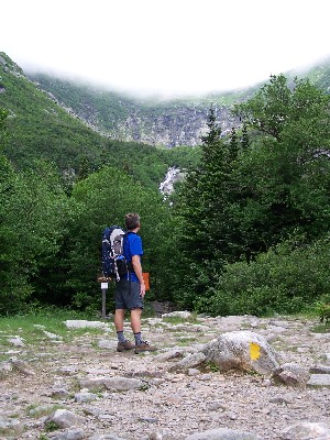
An early look at the ravine
headwall.
headwall.
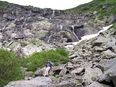
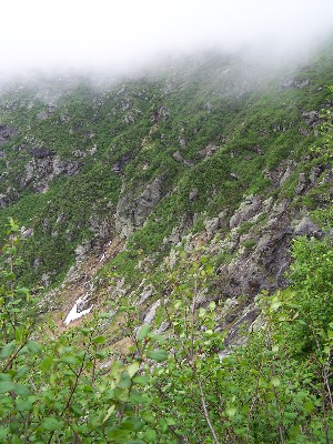
A little bit of snow and plenty of
water are still here.
water are still here.
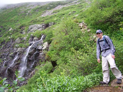
At the top of the headwall.
A little higher and we'll be in the
clouds.
clouds.
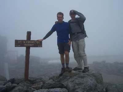
Once again at the top. It was
obviously blowing hard.
obviously blowing hard.
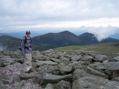
We ran outside during a break in the
clouds for this picture of the auto
road and the Presidential range in
the background.
clouds for this picture of the auto
road and the Presidential range in
the background.
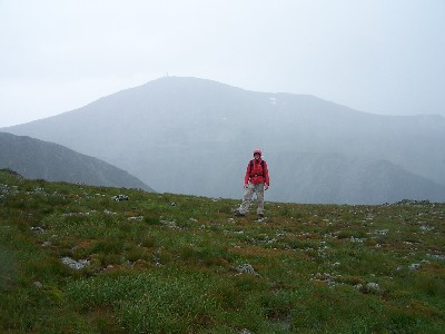
Tuckerman Ravine is between
us and the peak. The rain gear
came in handy again.
us and the peak. The rain gear
came in handy again.