
Clingmans Dome
| Tennessee |
Elevation: 6,643'
Vertical Gain: 2,370'
Vertical Gain: 2,370'
Date: April 22, 2011
Time: 11:40 AM
Time: 11:40 AM
Weather: Cool, foggy, wet
Party: Bob, Kevin
Party: Bob, Kevin
I was looking forward to seeing the Great Smoky Mountains National Park to see if I would
remember any of it from a visit there as a kid. I certainly still have a good recollection of my first
face to face encounter with a bear when I stuck my head out of our tent after hearing it at some
trash cans, only to see it's silhouette ambling right towards me and through our campsite.
When I was not able to get reservations for the Mt Collins shelter even a few weeks in advance,
I didn't mind taking that as an excuse to spend a second night in the park and add a half day to
the itinerary. The Mt Collins shelter is a half mile off the Appalachian Trail and I expected it to
be busy since it is nearly 200 miles from where over a thousand through hikers would have
already started their journey at Springer Mountain, Georgia. Being squeezed into bunks with
those hikers would have been, uh ..., interesting, but the drawback to having our relatively
deluxe camping would be another hard hiking day since we wouldn't be splitting up the hike
across two days.
After the drive up from Brasstown Bald the previous day, Kevin and I made the obligatory stop
at the new Oconaluftee Visitor Center and wandered around the farm display out back which
was recreated using actual buildings from some of the park's early inhabitants. Kevin took an
interest in the way the original mountain families worked their primitive farms from the early
1800's until the park was established in 1934. A short way up the road from there is the
Smokemont campground where we had no trouble finding a site without reservations, even
with most of the campground closed off for the season. One thing we did have trouble with
was getting a good fire going for the second time this trip. Since I had purchased a new,
up-to-date atlas at the visitor center we no longer needed the old one and started sacrificing
pages from it which did the trick to get the fire going.
In the morning we woke up to the sound of rain on the tent which was enough of an excuse to
sleep a little more until we knew we should get going. Once again the tent was put away wet
and we drove up the Newfound Gap Road (route 441) to the Newfound Gap parking area. At
8:46, in cool, foggy conditions we started up on this out-and-back hike on the AT which
roughly parallels the Clingmans Dome road to the summit. Kevin was feeling challenged again,
barely letting me stop for a photo or two despite the rough uphill trail, and we were on the
summit tower less than three hours later. The chatty ranger there saw us looking for a place
out of the wind to have our lunch and suggested we walk around to an alcove under the tower
walkway ramp. He was not at all kidding when he said to make sure there were no bears in
there first. Not wanting to add another mile by walking down to the parking lot we took him up
on his offer. Although it was dark and dank, it was out of the wind so we ate a quick lunch
there. We headed off the summit at 12:16 and a short way down we passed a woman who
suddenly exclaimed "It's so great that you are really hiking this trail!". A few strides later I
realized that despite our small packs she mistook us for one of the many through hikers
coming through the area. (It also made me realize it is probably time for a shave and a shower!)
We finished up the 7.9 mile return trip at 2:56, which was a good pace for the terrain of just
over 20 minutes per mile.
The weather became nicer as we drove down from Newfound Gap towards our next
destination - the scenic loop drive of the Roaring Fork Motor Nature Trail. I didn't realize that
you have to actually exit the park through the town of Gatlinburg to get to the entrance of the
loop. As soon as you get into Gatlinburg it is tourist city and it is the opposite of what the park
is all about. It seemed odd to me that the type of people that would be attracted to the quiet,
beautiful, and natural park would also like this tourist haven. We couldn't even find a place to
(legally) park while I sent Kevin to run into a Subway to pick up meatball subs for dinner.
From there, it was back into the park and onto the Laurel Creek Road for a nice scenic drive
along the river to the Cades Cove campground. After setting up camp we thought the evening
would be good for spotting wildlife on the 11-mile Cades Cove loop drive. We did see turkeys,
deer, and nice scenery but no bears. Kevin enjoyed the stops to visit some of the historic
buildings and it was dark by the time we finished the loop.
Although it wasn't cold, several times that evening wind gusts blew the tent walls down so far
they nearly covered our faces before springing back up. At about 1:00 AM, Kevin finally said
what I was already thinking but putting off - that we needed to get out and put some more
tie-downs on the tent. Once we did, he then somehow talked me into taking a walk to see if we
could find any of those bears we heard so much about. So we donned our headlamps and
walked around the dirt roads of the campground aiming them into the woods. Much to my
surprise, we did see about a half-dozen sets of lit up eyes staring back at us. From the
movement, we figured most of them belonged to deer but we did get one good look at a fox
when we both put our beams on high and it turned sideways to jump away. Still, we couldn't
confirm that any of those beady eyes were bears.
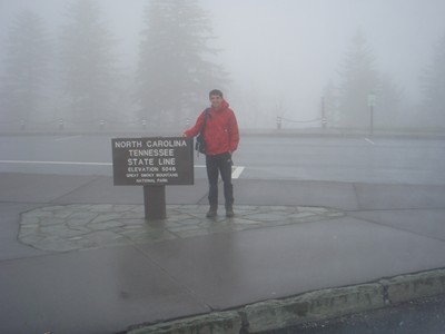
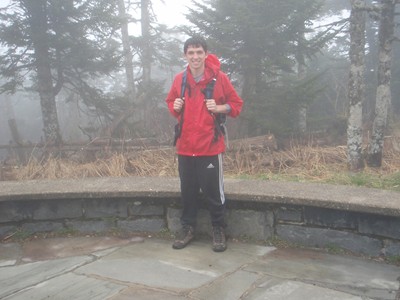
As ready as we'll ever be to start
this one, right on the border of
North Carolina.
this one, right on the border of
North Carolina.
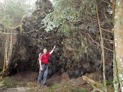
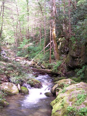
There was a section where large
trees blew down not too long ago.
trees blew down not too long ago.
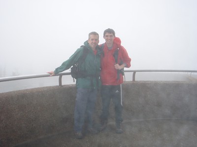
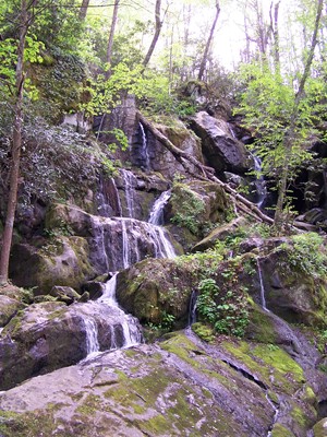
Not much view today but the ranger thought
it was nice that it wasn't freezing out.
it was nice that it wasn't freezing out.
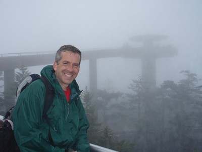
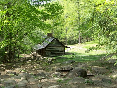
Kevin's future home?
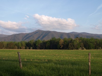
Had to throw in some shots of the scenery on the way to and in Cades Cove.