Black Mtn
| Kentucky |
Elevation: 4,145'
Vertical Gain: 0'
Vertical Gain: 0'
Date: April 18, 2011
Time: 3:30 PM
Time: 3:30 PM
Weather: Cool, light haze
Party: Bob, Kevin
Party: Bob, Kevin
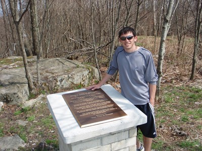
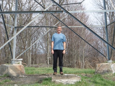
Knocking off the Kentucky high point after Virginia and before North Carolina was not the
most efficient for driving time but it worked best with the tight itinerary we had. After
descending from Mount Rogers it was a several hour drive to Black Mountain during which we
saw some large coal mining operations. This summit, which is just over the border of Virginia,
is actually owned by a coal mining company which requests that a waiver be signed first. I had
mailed them in about two weeks earlier although there was nobody around to check them and
the 1.7 mile dirt road to the summit was far away from any visible mining activity. This
mountain is an "allowed" drive-up because there is no alternative. There is a radar installation
that we passed just before the top and an old fire tower at the wooded summit. One other
person was just about to drive away as we arrived and we then had it to ourselves although
we didn't stay long.
On the drive to North Carolina I learned to be more careful with trusting technology. When
setting up the GPS, I plugged in our destination town without a specific address thinking I
knew close enough where we had to go once we got to route 80 in town. We were blindly
following the GPS and were a couple of exits past the route I was expecting before I started
questioning it and asking Kevin to check the maps. By that time it was best to continue
following the route the GPS selected even though it didn't seem optimal. Once again I was
questioning as it took us through these small towns and eventually onto a dirt road but Kevin
insisted we proceed. With little gas in the tank, no food for dinner or hiking the next day, and
being on a single lane dirt road that was winding through some hilly North Carolina back
woods for about eight miles, I was getting nervous. Kevin was right and we did finally pop out
on the Blue Ridge Parkway but then it was another twenty miles to our next turn. We pulled
into the Black Mountain campground with the gas gauge on "E" and of course one of the first
questions to the friendly woman tending the campground was where we could find gas and
food. After quickly setting up the tent we headed the couple miles back out to the main road to
get there before they closed. The first recommendation was to go back the way we came for a
few miles to what I thought were abandoned gas pumps so instead we took the second
recommendation and headed a few miles further north up route 80 to a general store which
didn't look much bigger or more modern than the first. We were happy to have anything at that
point even though all we could come up with there that didn't require cooking was cheese and
crackers and peanut butter and jelly for dinner, and a few snacks and more peanut butter and
jelly for the next day's lunch.
Kevin at the high point plaque which
looks pretty new and Bob under the
fire tower which looks pretty old.
looks pretty new and Bob under the
fire tower which looks pretty old.