Mount Frissell
| Connecticut |
Elevation: 2,380'
Vertical Gain: 548'
Vertical Gain: 548'
Date: November 5, 2005
Time: 10:40 AM
Time: 10:40 AM
Weather: Fair and warm
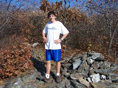
Party: Bob, Kevin
Party: Bob, Kevin
This was an unseasonably warm and nice day for November to make a trip to the second
closest highpoint to our home. We had a nice drive up through Amenia and Millerton, NY and
to Salisbury, CT. From the town hall it was over six miles of dirt road to the CT-MA border. We
started hiking about 10:00 on a nice trail along the border over Round Mountain which was
steep in spots and with views. It was 1.3 miles to the highpoint which was reached by hiking a
few hundred yards down Mt Frissell. Connecticut is the only highpoint that is on the shoulder
of a mountain whose peak is in another state. We continued on another .2 miles to the tri-state
marker for CT-MA-NY. On the way back down a couple of women offered us some Snickers
which we were happy to take. We then hiked in the other direction for 1.5 miles to the top of
crowded Bear Mountain where the large rock cairn was significantly lower than when I was
there as a kid. Bear Mountain is the highest peak in Connecticut, not the highest point but
when we overheard people talking about being at the highest spot in Connecticut we didn't
have the heart to correct them.
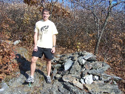
A small cairn and
pipe marks the true
CT highpoint.
pipe marks the true
CT highpoint.