
Humphrey's Peak
| Arizona |
Elevation: 12,633'
Vertical Gain: 3,213'
Vertical Gain: 3,213'
Date: August 10, 2007
Time: 12:35 PM
Time: 12:35 PM
Weather: Nice, clear
Party: Bob, Kevin
Party: Bob, Kevin
Humphrey's Peak was the first high point of a three state, one week highpointing tour of the
Southwest. Kevin and I flew into Las Vegas and travelled to the high points of Arizona,
Nevada, and California, returning to Las Vegas. There, Pam, Emily, and Colleen joined us for a
very different second week of vacation where we took in the sights of Las Vegas, Sequoia
National Park, Monterey, Carmel, the California coast, and Los Angeles.
After a long first day of travelling due to a missed connection in Cleveland forcing us to go
through Houston we were happy to see that our bags were already there waiting for us. We
drove for about two hours, over the Hoover Dam, as far as Kingman, AZ when we got too tired
to continue at about 11:00 PM Pacific Time. There, we stopped at a truck and RV parking area
next to a highway, train tracks, and a McDonalds for a few hours of interrupted sleep in the
rented Jeep Commander. For an SUV, there was not very much room in the back, especially
with all the gear too so while I curled up among the sleeping bags Kevin stayed in the
passenger seat. With the light of dawn at 6:00, we continued on a couple more hours to the
mountain. It took us about a half hour to get the day packs organized at the Arizona Snobowl
ski area where there were already about a dozen cars. We started off at 9:00 with perfect hiking
weather, cool and sunny, and we were both hiking strong until precisely 11,400' when the
breathing became noticeably harder for the pace. The views were great upon reaching the
saddle. The last 1000' of elevation gain seemed hard due to a false summit. We stayed about
45 minutes at the top where we could see as far as the north rim of the Grand Canyon. We had
the summit to ourselves for half an hour. Kevin was feeling some fatigue, nausea, and
headache effects from the altitude so we headed back down. This first level of altitude
sickness is known as AMS (Acute Mountain Sickness) and it supposedly hits younger people
a little harder. He was feeling better right about 11,400' again so I guess we know the limit with
zero aclimization (and little sleep). AMS was not a problem on Boundary Peak or Mt Whitney
after this, which are both higher.
The GPS recorded round trip distance was 10.0 miles, of which 4 and a half hours was actual
hiking time. This was a great pace for the terrain so we knew we were in good shape for the
mountains to come.
Several people we talked to recommended visiting Sedona, so since we still had time after
visiting a camp store in Flagstaff for stove fuel we drove south through Oak Creek Canyon to
Sedona and back to camp near the mountain at the lonely and quiet distributed camping area.
It was dusk by then, having stopped for big burgers at Denny's. A pack of noisy coyotes in the
morning let us know we at least had some neighbors.
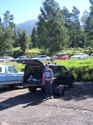
Ready to hit the trail at the base of the
Arizona Snobowl ski area.
Arizona Snobowl ski area.
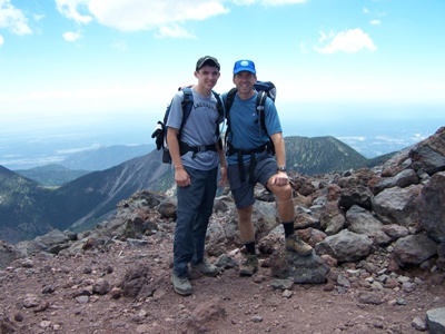
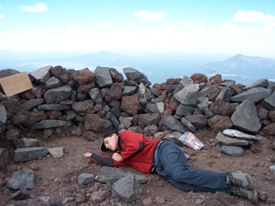
The official summit pose ...
followed by a quick nap.
followed by a quick nap.
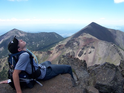
Kevin soaking in some rays
on the summit ridge.
on the summit ridge.
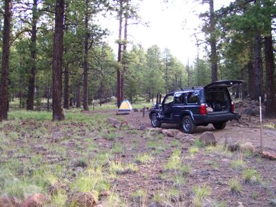
Our home the night after
our climb.
our climb.